Saturday, May 7, 2011

The Black Forest

We went to Triberg which is in the middle of the Black Forest in April and saw the biggest waterfall in Germany! We parked in lot #3 which was pretty much empty and free! Lyssa was excited about parking here because it was right next to a gelatno shop (which is some of the best ice cream in the world!!!) As soon as we got out of the car we could hear water trickling/flowing from a cute little bubbling brook that runs a VERY long ways! We started to see the brook about 45 minutes before we even arrived at Triberg. The highway seemed to run along it! It was pretty neat to watch it get bigger and bigger the closer we got to the water fall.

  
This is the brook right next to the parking lot.
After we got our bearings we started our climb towards the waterfall. It was quite the hike! It wasn't so much the distance, but the incline was killer! It was well worth it though. The view was beautiful! Below are some of my favorite pictures that Lyssa and I took.


The two pictures above are from the first level of the waterfall. There are three or four levels in all. At the top level there are zip lines that you can ride to get a GREAT view of the area!


 After we spent some time watching the waterfall and hiking (aka climbing) all over it we went into the town and looked at several different cookoo clock shops. This particular area of the Black Forest is famous for its cookoo clock and I do have to say that the craftsmanship on this is excellent. I did end up buying one, but I haven't quite figured out where I want to put it yet.

After we went shopping, we decided to go see the Worlds Biggest Cookoo clock! We got there before it was officially open for tourist season, but I did get a couple of pictures!

This is the outside of the clock with Lyssa's friend Nymuie posing for me!
This is the inside of the clock with Lyssa being guilted into posing for me!
I really enjoyed our trip to the Black Forest and I am looking forward to going again! There is also a museum that we went to that had a lot of history of the Black Forest. Did you know that what we call calliopes were invented here? They have several of the first versions of them that actually run and that you can watch and listen to. They are pretty neat! I can't wait to go again!

Wednesday, May 4, 2011

Luxembourg, Luxembourg

Sorry I have been so behind in my posts! So much has been going on, its been hard to keep up! I do have some down time now so I am going to try and catch up with some posts this week!

Back in March, Lyssa, Tim, and I went to the capital of Luxembourg which also happens to be called Luxembourg! It is a very small country situated in between France and Germany. They speak French there as well. Did you know that it is very confusing to go from learning German and hearing German spoke all the time to all of a sudden hearing French everywhere?! It is very confusing!!

Anyways, the main attraction in Luxembourg is the old fortress called the Bock Casements built in 1644. It's 14 miles long and up to 131 feet deep in places and it is built entirely out of stone!

This is one of the MANY tight and steep spiral staircases that leads up from the crypt.

Picture of the outside of the fortress

A large section of the fortress

  
One of the remaining towers.
There is also a Roman Aqueduct that has been rebuilt and is still in use today as a train bridge.


There is also a "modern" castle. It was built in the late 1700's and is still the site of the country's government offices. There is a guard on duty at all times pacing back and forth marking off the time. It's kind of fun to watch! Below are some pictures of the castle that I was able to get before we had to leave!


The Royal Crest

   
I just love the detail carved into the walls! This is only a minor part of it and the building is covered in it!
Along with the castle and fort there was an open air market where people were selling fresh veggies, fruit, meats and cheeses, and my favorite, wine! One thing that we didn't get to see was the butterfly garden. It was closed for the winter, but I am planning on going back. Overall we had a good time and it's definatly a place worth visiting!

Saturday, March 12, 2011

How Does This Work??!!!!!

I've come across several different things here in Germany that are....different. Not just the language and culture, but objects as well. I've decided to take pictures of the "odd" things that I find and post them on here and maybe we can figure it all out. 

This time I've chosen to show you my stove. On the outside it looks like any normal stove...


BUT it's not!  When I tried to pull the door open, I couldn't! Then Ewald (the landlord) showed me how to open it...


You PULL it open!

Then later that night we decided to make frozen pizza for dinner, so I went to preheat the oven, so I converted the Fahrenheit to Celsius, turned the dial to the correct temperature and then went to put the setting in and found this....


I was floored!!! I couldn't figure out which setting was what and which one to use!!! So I randomly chose one and was I WRONG!!! The top of the pizza ended up burnt, and the bottom ended up doughy!! OOPS!!!! With some trial and error (lots and lots of error), I think that the stove is convection and that the picture with the lines on the top and bottom is the correct setting to use when cooking. As for what the others do, I have no idea! Some of the settings use a fan, but other than that, I've no earthly idea!!!

If anyone out there can help I'll take any advice!!! 

Kylie

Random Pictures

My friend Jennifer and I took a trip to Ramstein AFB the other day and took the pictures below on the way! It was a wonderfully clear day with hardly any haze! Those are a rare thing around here.

This is the view right outside the town we live in. There are mountains behind those hills!


View of the far away mountains


One of the cute little towns! There is a castle in this town that partially fallen down,but the base has been preserved and made into a steak restaurant.

These are the road signs that are over a lot of the autobahn. The signs mean (from the left to the right) merge right, construction ahead, speed limit 80kph, construction ahead, and the speed limit.

Sunday, February 27, 2011

Necharsteinach and the Four Castles


Sorry I haven’t posted in awhile, we have just been so busy it’s been hard to have some time to sit down and put together a post with all of the pictures that I have!!!

Two weeks ago we went to Necharsteinach to visit the four castles there! Two of the four are currently occupied and we were only able to see the outside of one of them, but it was still very neat to see!!!

This is the outside of the first castle:


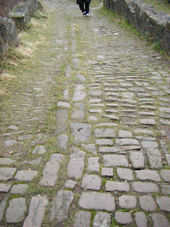
This is the walkway from the first castle to the second castle. I think that these are my favorite pictures:


You can see the second castle from this picture (and a little bit of Tim!)
 
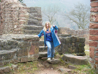
The third castle is in ruin and we were able to climb all over it and explore it. It was VERY neat! I think that my favorite part was the windows next to the tower. You could still see the original outline and details of how the windows would have been placed in them!

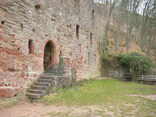
This castle is called Hintersburg and was built in the 12th century and took about 30 years to build! It is the closest of all the castles to the river.

This is a miniature history of the castle. I have been unable to find a translation of this, but I’m still working on it!

Stairs going up to the castle
The watch tower
This is the view form the top of the watch tower

This is the orinigal layout of the castle. Most of the outer walls have disappeared, but the inner part is still standing and that’s what we were able to explore!


This next castle is quite a ways up from the last castle. This castle has two towers and is called the Schadeck. It was built in the 13th century. The castle is almost on the top of the mountain and is hard to see from the bottom!


These are all views of the fourth castle from various positions on the way up the path. They are a bit hazy because it so high up that we were up in the clouds!


The pictures below are taken from the top of the tower. The fields are on the other side of the river and have been farmed since even before any of the castles were built. On clearer days you can see paths worn into the land by the farmers and villagers going to and from the fields, and the paths they used to bring water up to the crops from the river.


All of the castles are very neat and breath taking! And the views are awesome! The way up to the castles is very steep! We all (even Lyssa!) had to stop a few times to catch our breath. The paths are at least at a 20-30% incline and some are possibly even 40%! But it’s worth it if you can make it!